 vesseltracker.com
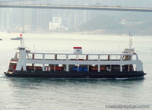
 Man Kai
Current Status
Where is the vessel?
Man Kai is currently in Near Kwun Tong, based on AIS data received less than 1h ago.
Latest AIS update:
Current position: 22.30757° N, 114.22025° E (Near Kwun Tong)
Average speed (last 7 days): Loading…
Average speed (last 30 days): Loading…
Vessel profile: Man Kai is a Passenger Ro Ro Cargo Ship with dimensions 64m x 13m.
This page combines live AIS, route history, probable destination signals, nearby traffic, and port activity for practical vessel monitoring.
The current position of vessel Man Kai is 22.30757 lat / 114.22025 lng. Updated: 2026-04-02 09:40:13 UTCNearest reference points:
- Near Lei Yue Mun
- Near Causeway Bay
- Near Hong Kong
Currently sailing under the flag of Hong Kong ![]()
Man Kai built in 1985 year
Deadweight:
345 tDetails:
Live Vessel Man Kai Analytics (details, animations, etc.)
Recent AIS points (UTC):
2026-04-02 03:31:43 UTC · 22.29460, 114.20320 · SOG 0.1 kn · COG -1°2026-04-02 06:00:21 UTC · 22.30740, 114.22025 · SOG 1 kn · COG -1°
2026-04-02 07:42:51 UTC · 22.30083, 114.21910 · SOG 7.5 kn · COG -1°
2026-04-02 09:40:13 UTC · 22.30757, 114.22025 · SOG 0 kn · COG -1°