 vesseltracker.com
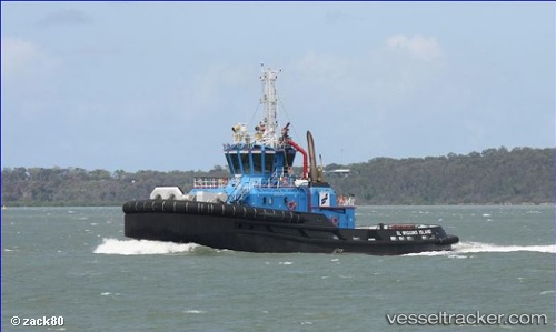
 Sl Wiggins Island
Current Status
Where is the vessel?
Sl Wiggins Island is currently in Near GLADSTONE, based on AIS data received less than 1h ago.
Latest AIS update:
Current position: 23.82411° S, 151.24313° E (Near GLADSTONE)
Average speed (last 7 days): Loading…
Average speed (last 30 days): Loading…
Vessel profile: Sl Wiggins Island is a Tug with dimensions 34m x 14m.
This page combines live AIS, route history, probable destination signals, nearby traffic, and port activity for practical vessel monitoring.
The current position of vessel Sl Wiggins Island is -23.82411 lat / 151.24313 lng. Updated: 2026-03-31 08:00:33 UTCNearest reference points:
- Near Gladstone Harbor
- Near Boyne Island
- Near ROSSLYN
Currently sailing under the flag of Australia ![]()
Details:
Live Vessel Sl Wiggins Island Analytics (details, animations, etc.)
Recent AIS points (UTC):
2026-03-31 02:10:24 UTC · -23.82333, 151.24333 · SOG 0 kn · COG -1°2026-03-31 03:57:17 UTC · -23.82486, 151.24391 · SOG 0 kn · COG 74°
2026-03-31 06:25:25 UTC · -23.82333, 151.24167 · SOG 0 kn · COG -1°
2026-03-31 08:00:33 UTC · -23.82411, 151.24313 · SOG 0 kn · COG 75°