 vesseltracker.com
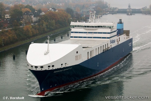
 Searoad Mersey 2
Current Status
Where is the vessel?
Searoad Mersey 2 is currently in 46 nm N of STANLEY, based on AIS data received about 1h ago.
Latest AIS update:
Current position: 40.05467° S, 145.67645° E (46 nm N of STANLEY)
Average speed (last 7 days): Loading…
Average speed (last 30 days): Loading…
Vessel profile: Searoad Mersey 2 is a Container Ro Ro Cargo Ship with dimensions 182m x 30m.
This page combines live AIS, route history, probable destination signals, nearby traffic, and port activity for practical vessel monitoring.
The current position of vessel Searoad Mersey 2 is -40.05467 lat / 145.67645 lng. Updated: 2026-04-07 16:11:25 UTCNearest reference points:
- Near Beaconsfield
- Near Hastings
- Near QUEENSCLIFF
Currently sailing under the flag of Australia ![]()
Details:
Live Vessel Searoad Mersey 2 Analytics (details, animations, etc.)
Recent AIS points (UTC):
2026-04-07 09:41:42 UTC · -38.30693, 144.75661 · SOG 19.6 kn · COG 282°2026-04-07 12:18:53 UTC · -38.94284, 144.98166 · SOG 18.9 kn · COG 156°
2026-04-07 13:49:34 UTC · -39.37667, 145.24167 · SOG 19 kn · COG -1°
2026-04-07 16:11:25 UTC · -40.05467, 145.67645 · SOG 19.1 kn · COG 155°