 vesseltracker.com
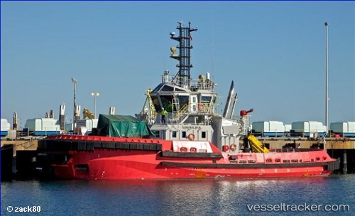
Barrura
Current StatusWhere is the vessel?
Barrura is currently in Near PORT WALCOTT, based on AIS data received about 9h ago.
Latest AIS update:
Current position: 20.57289° S, 117.21624° E (Near PORT WALCOTT)
Average speed (last 7 days): Loading…
Average speed (last 30 days): Loading…
Vessel profile: Barrura is a Tug with dimensions 13m x 32m.
This page combines live AIS, route history, probable destination signals, nearby traffic, and port activity for practical vessel monitoring.
The current position of vessel Barrura is -20.57289 lat / 117.21624 lng. Updated: 2026-04-10 07:46:43 UTCNearest reference points:
- 11 nm E of Port Walcot
- 116 nm NE of Mutineer
Details:
Live Vessel Barrura Analytics (details, animations, etc.)
Recent AIS points (UTC):
2026-04-10 01:39:06 UTC · -20.59166, 117.16833 · SOG 0 kn · COG -1°2026-04-10 04:12:03 UTC · -20.59166, 117.16833 · SOG 0 kn · COG -1°
2026-04-10 05:45:53 UTC · -20.57207, 117.20665 · SOG 6.6 kn · COG 68°
2026-04-10 07:46:43 UTC · -20.57289, 117.21624 · SOG 8 kn · COG 80°