 vesseltracker.com
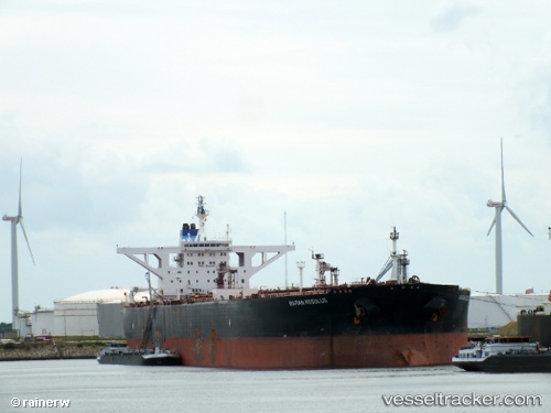
 VIKI
VIKI
Current Status
Where is the vessel?
VIKI is currently in Near Free Port, based on AIS data received about 49d ago.
Latest AIS update:
Current position: 25.30017° N, 55.17157° E (Near Free Port)
Average speed (last 7 days): Loading…
Average speed (last 30 days): Loading…
Vessel profile: VIKI is a Crude Oil Tanker with dimensions 58m x 333m.
This page combines live AIS, route history, probable destination signals, nearby traffic, and port activity for practical vessel monitoring.
The current position of vessel VIKI is 25.30017 lat / 55.17157 lng. Updated: 2026-02-21 14:02:55 UTCNearest reference points:
- Near Free Port
- Near DUBAI
- Near Dubai
Currently sailing under the flag of Palau (Republic of) ![]()
VIKI built in 2000 year
Deadweight:
310106 tDetails:
Live Vessel VIKI Analytics (details, animations, etc.)
Recent AIS points (UTC):
2026-02-21 14:02:55 UTC · 25.30017, 55.17157 · SOG 7.9 kn · COG 194°