 vesseltracker.com
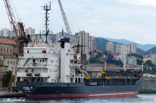
 SEA BREEZE
Current Status
Where is the vessel?
SEA BREEZE is currently in Near Iraklion, based on AIS data received less than 1h ago.
Latest AIS update:
Current position: 35.34481° N, 25.14724° E (Near Iraklion)
Average speed (last 7 days): Loading…
Average speed (last 30 days): Loading…
Vessel profile: SEA BREEZE is a Bulk Carrier with dimensions 101m x 16m.
This page combines live AIS, route history, probable destination signals, nearby traffic, and port activity for practical vessel monitoring.
The current position of vessel SEA BREEZE is 35.34481 lat / 25.14724 lng. Updated: 2026-04-17 21:29:57 UTCNearest reference points:
- Near Iraklion
- Near Kali Limenes
- 20 nm S of Astypálaia
Currently sailing under the flag of Palau (Republic of) ![]()
SEA BREEZE built in 1972 year
Deadweight:
6370 tDetails:
Live Vessel SEA BREEZE Analytics (details, animations, etc.)
Recent AIS points (UTC):
2026-04-17 16:27:55 UTC · 35.34477, 25.14726 · SOG 0 kn · COG -1°2026-04-17 17:39:54 UTC · 35.34476, 25.14726 · SOG 0 kn · COG -1°
2026-04-17 19:52:59 UTC · 35.34474, 25.14726 · SOG 0 kn · COG -1°
2026-04-17 21:29:57 UTC · 35.34481, 25.14724 · SOG 0 kn · COG -1°