 vesseltracker.com
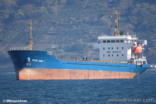
 RYONG BONG 1
Current Status
Where is the vessel?
RYONG BONG 1 is currently in Near Tai Lang Shui, based on AIS data received about 3h ago.
Latest AIS update:
Current position: 22.36752° N, 113.92479° E (Near Tai Lang Shui)
Average speed (last 7 days): Loading…
Average speed (last 30 days): Loading…
Vessel profile: RYONG BONG 1 is a Cargo with dimensions m x m.
This page combines live AIS, route history, probable destination signals, nearby traffic, and port activity for practical vessel monitoring.
The current position of vessel RYONG BONG 1 is 22.36752 lat / 113.92479 lng. Updated: 2026-04-22 23:57:01 UTCNearest reference points:
- Near Tai Lang Shui
- Near Tuen Mun
- Near Ma Wan
Currently sailing under the flag of Palau ![]()
Details:
Live Vessel RYONG BONG 1 Analytics (details, animations, etc.)
Recent AIS points (UTC):
2026-04-22 19:29:58 UTC · 22.36753, 113.92479 · SOG 0 kn · COG 311°2026-04-22 21:20:58 UTC · 22.36752, 113.92477 · SOG 0 kn · COG 310°
2026-04-22 22:12:01 UTC · 22.36752, 113.92477 · SOG 0 kn · COG 310°
2026-04-22 23:57:01 UTC · 22.36752, 113.92479 · SOG 0.1 kn · COG 311°