 vesseltracker.com
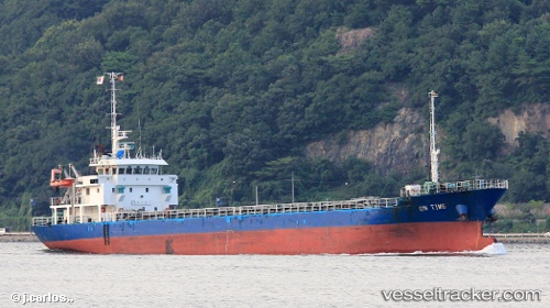
 SWIFT
SWIFT
Current Status
Where is the vessel?
SWIFT is currently in 48 nm N of Nanao, based on AIS data received less than 1h ago.
Latest AIS update:
Current position: 37.83763° N, 137.20930° E (48 nm N of Nanao)
Average speed (last 7 days): Loading…
Average speed (last 30 days): Loading…
Vessel profile: SWIFT is a Cargo with dimensions m x m.
This page combines live AIS, route history, probable destination signals, nearby traffic, and port activity for practical vessel monitoring.
The current position of vessel SWIFT is 37.83763 lat / 137.20930 lng. Updated: 2026-04-08 13:33:03 UTCNearest reference points:
- 63 nm NW of Sado Shima Apt
- Near Toyama
- Near Yokohama
Currently sailing under the flag of Palau ![]()
Details:
Live Vessel SWIFT Analytics (details, animations, etc.)
Recent AIS points (UTC):
2026-04-08 07:32:07 UTC · 36.96833, 137.19167 · SOG 10 kn · COG -1°2026-04-08 09:38:03 UTC · 37.29288, 137.35699 · SOG 9.8 kn · COG 25°
2026-04-08 12:14:43 UTC · 37.67584, 137.37016 · SOG 9.5 kn · COG 322°
2026-04-08 13:33:03 UTC · 37.83763, 137.20930 · SOG 9.2 kn · COG 321°