 vesseltracker.com
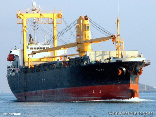
 Mv.sinar Kudus
Current Status
Where is the vessel?
Mv.sinar Kudus is currently in 26 nm S of Dumai, based on AIS data received about 1152d ago.
Latest AIS update:
Current position: 1.26330° N, 101.44488° E (26 nm S of Dumai)
Average speed (last 7 days): Loading…
Average speed (last 30 days): Loading…
Vessel profile: Mv.sinar Kudus is a General Cargo Ship with dimensions 70m x 112m.
This page combines live AIS, route history, probable destination signals, nearby traffic, and port activity for practical vessel monitoring.
The current position of vessel Mv.sinar Kudus is 1.26330 lat / 101.44488 lng. Updated: 2023-02-25 07:05:06 UTCNearest reference points:
- Near Dumai
- 34 nm NW of FUTONG
- 14 nm W of SUNGAI UDANG
Currently sailing under the flag of Indonesia ![]()
Mv.sinar Kudus built in 1999 year
Deadweight:
8911 tDetails:
Live Vessel Mv.sinar Kudus Analytics (details, animations, etc.)
Recent AIS points (UTC):
2023-02-25 07:05:06 UTC · 1.26330, 101.44488 · SOG 0.1 kn · COG 0°