 vesseltracker.com
 Mv.omarrasheed
Current Status
Where is the vessel?
Mv.omarrasheed is currently in 39 nm W of Panakukang, based on AIS data received about 3h ago.
Latest AIS update:
Current position: 5.26313° S, 118.73070° E (39 nm W of Panakukang)
Average speed (last 7 days): Loading…
Average speed (last 30 days): Loading…
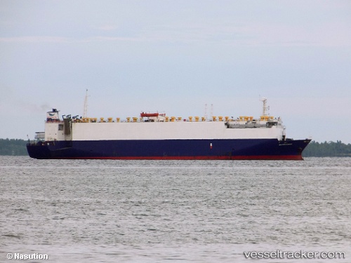
Vessel profile: Mv.omarrasheed is a Vehicles Carrier with dimensions 116m x 18m.
This page combines live AIS, route history, probable destination signals, nearby traffic, and port activity for practical vessel monitoring.
The current position of vessel Mv.omarrasheed is -5.26313 lat / 118.73070 lng. Updated: 2026-03-27 04:57:15 UTCNearest reference points:
- 12 nm W of Panakukang
- Near Panakukang
- Near Makassar
Currently sailing under the flag of Indonesia ![]()
Mv.omarrasheed built in 1985 year
Deadweight:
5705 tDetails:
Live Vessel Mv.omarrasheed Analytics (details, animations, etc.)
Recent AIS points (UTC):
2026-03-26 23:52:40 UTC · -5.15040, 119.36664 · SOG 0.1 kn · COG -1°2026-03-27 01:44:50 UTC · -5.15795, 119.32997 · SOG 8.7 kn · COG -1°
2026-03-27 02:53:27 UTC · -5.20337, 119.12208 · SOG 11.5 kn · COG -1°
2026-03-27 04:57:15 UTC · -5.26313, 118.73070 · SOG 11.6 kn · COG -1°