 vesseltracker.com
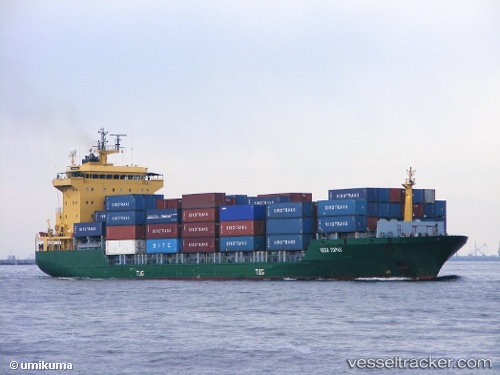
Tanto Tenang
Current StatusWhere is the vessel?
Tanto Tenang is currently in 74 nm N of Arjasa, based on AIS data received less than 1h ago.
Latest AIS update:
Current position: 5.67380° S, 115.64232° E (74 nm N of Arjasa)
Average speed (last 7 days): Loading…
Average speed (last 30 days): Loading…
Vessel profile: Tanto Tenang is a Container Ship with dimensions 22m x 135m.
This page combines live AIS, route history, probable destination signals, nearby traffic, and port activity for practical vessel monitoring.
The current position of vessel Tanto Tenang is -5.67380 lat / 115.64232 lng. Updated: 2026-04-21 08:17:21 UTCNearest reference points:
- 74 nm S of MEKAR PUTIH
- 70 nm S of MEKAR PUTIH
- 34 nm N of Arjasa
Details:
Live Vessel Tanto Tenang Analytics (details, animations, etc.)
Recent AIS points (UTC):
2026-04-20 18:06:22 UTC · -5.54098, 117.95708 · SOG 9.1 kn · COG -1°2026-04-21 05:18:13 UTC · -5.67444, 116.14068 · SOG 10.2 kn · COG -1°
2026-04-21 05:55:12 UTC · -5.67493, 116.03447 · SOG 10.3 kn · COG -1°
2026-04-21 08:17:21 UTC · -5.67380, 115.64232 · SOG 9.3 kn · COG -1°