 vesseltracker.com
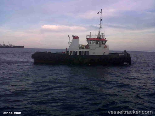
Pesut Ii
Current StatusWhere is the vessel?
Pesut Ii is currently in Open sea (no nearby ports in database), based on AIS data received about 215d ago.
Latest AIS update:
Current position: 30.16239° S, 105.00329° E (Open sea (no nearby ports in database))
Average speed (last 7 days): Loading…
Average speed (last 30 days): Loading…
Vessel profile: Pesut Ii is a Offshore Tug Supply Ship with dimensions 10m x 37m.
This page combines live AIS, route history, probable destination signals, nearby traffic, and port activity for practical vessel monitoring.
The current position of vessel Pesut Ii is -30.16239 lat / 105.00329 lng. Updated: 2025-09-06 05:48:54 UTCNearest reference points:
- Open sea (no nearby ports in database)
- Open sea, approx. 438 nm off the nearest listed port
- Open sea, approx. 417 nm off the nearest listed port
Details:
Live Vessel Pesut Ii Analytics (details, animations, etc.)
Recent AIS points (UTC):
2025-09-06 05:48:54 UTC · -30.16239, 105.00329 · SOG 0 kn · COG -1°