 vesseltracker.com
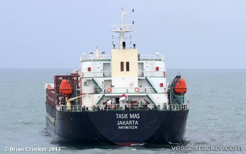
Tasik Mas
Current StatusWhere is the vessel?
Tasik Mas is currently in Near LAMONGAN, based on AIS data received less than 1h ago.
Latest AIS update:
Current position: 6.85416° S, 112.44069° E (Near LAMONGAN)
Average speed (last 7 days): Loading…
Average speed (last 30 days): Loading…
Vessel profile: Tasik Mas is a Container Ship with dimensions 22m x 120m.
This page combines live AIS, route history, probable destination signals, nearby traffic, and port activity for practical vessel monitoring.
The current position of vessel Tasik Mas is -6.85416 lat / 112.44069 lng. Updated: 2026-04-01 19:21:52 UTCNearest reference points:
- Near LAMONGAN
- Near Bangkalan
- Near GRESIK
Details:
Live Vessel Tasik Mas Analytics (details, animations, etc.)
Recent AIS points (UTC):
2026-04-01 13:45:51 UTC · -6.85437, 112.44056 · SOG 0 kn · COG -1°2026-04-01 15:39:52 UTC · -6.85429, 112.44061 · SOG 0.2 kn · COG -1°
2026-04-01 17:45:51 UTC · -6.85423, 112.44061 · SOG 0.1 kn · COG -1°
2026-04-01 19:21:52 UTC · -6.85416, 112.44069 · SOG 0.1 kn · COG -1°