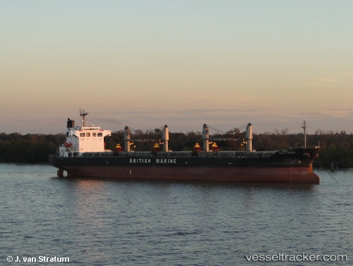
.
Vessel photo of Rashad (IMO 9220718) vesseltracker.com

Rashad

Vessel type: Bulk Carrier | IMO: 9220718 | MMSI: MMSI: 525020411
Call sign: YBJS2 | Dimensions: 32 m x 187 m
Current Status

Where is the vessel?

Rashad is currently in Near Madura Terminal, based on AIS data received about 511d ago.

Latest AIS update:

Current position: 6.86783° S, 112.82250° E (Near Madura Terminal)

Average speed (last 7 days): Loading…

Average speed (last 30 days): Loading…

Vessel profile: Rashad is a Bulk Carrier with dimensions 32m x 187m.

This page combines live AIS, route history, probable destination signals, nearby traffic, and port activity for practical vessel monitoring.

The current position of vessel Rashad is -6.86783 lat / 112.82250 lng. Updated: 2024-11-27 05:37:12 UTC
Nearest reference points:
  • 11 nm W of Madura Terminal
  • Near Bangkalan
  • 10 nm W of Poleng
Details:

Live Vessel Rashad Analytics (details, animations, etc.)


Recent AIS points (UTC):
2024-11-27 05:37:12 UTC · -6.86783, 112.82250 · SOG 0 kn · COG 332°

Track of the vessel in the last 60 days


UTC: --
Start: -- Track timeline (UTC) End: --
Encountered: --


Link to the map:


Find another ship

Rashad (525020411) last ports (portcalls and passsages)

GRESIK | 2024-11-16 04:09:50
GRESIK | 2024-11-12 02:56:16
Taboneo | 2024-08-30 01:51:42
Taboneo | 2024-08-26 01:27:40
Senipah Oil Terminal | 2024-08-11 02:28:02
Senipah Oil Terminal | 2024-08-06 07:18:32
Senipah Oil Terminal | 2024-05-28 11:30:31
Senipah Oil Terminal | 2024-05-24 11:26:25
Balikpapan | 2024-05-13 16:18:18
Muara Pantai | 2023-10-22 10:02:34
Muara Pantai | 2023-10-18 02:28:55
Muara Pantai | 2023-10-12 22:26:04
Muara Pantai | 2023-10-08 15:21:36
Balikpapan | 2023-09-09 00:29:28
Balikpapan | 2023-08-30 10:50:13
Balikpapan | 2022-02-03 04:46:36