 vesseltracker.com
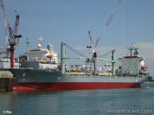
Meratus Manado
Current StatusWhere is the vessel?
Meratus Manado is currently in 39 nm SW of BAUBAU, based on AIS data received about 5h ago.
Latest AIS update:
Current position: 5.72678° S, 122.00537° E (39 nm SW of BAUBAU)
Average speed (last 7 days): Loading…
Average speed (last 30 days): Loading…
Vessel profile: Meratus Manado is a Container Ship with dimensions 22m x 145m.
This page combines live AIS, route history, probable destination signals, nearby traffic, and port activity for practical vessel monitoring.
The current position of vessel Meratus Manado is -5.72678 lat / 122.00537 lng. Updated: 2026-04-15 01:51:12 UTCNearest reference points:
- Near BAUBAU
- 83 nm SE of Panakukang
- 27 nm SW of Kolaka
Details:
Live Vessel Meratus Manado Analytics (details, animations, etc.)
Recent AIS points (UTC):
2026-04-14 22:07:55 UTC · -5.74175, 122.82438 · SOG 13.5 kn · COG -1°2026-04-14 23:48:37 UTC · -5.73408, 122.45600 · SOG 12.8 kn · COG -1°
2026-04-15 01:51:12 UTC · -5.72678, 122.00537 · SOG 13.3 kn · COG -1°
2026-04-15 01:51:12 UTC · -5.72678, 122.00537 · SOG 13.3 kn · COG -1°