 vesseltracker.com
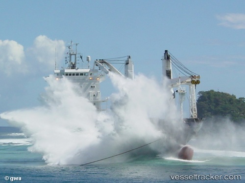
Mv. Red Rock
Current StatusWhere is the vessel?
Mv. Red Rock is currently in 30 nm NE of Sape, based on AIS data received about 1h ago.
Latest AIS update:
Current position: 8.13333° S, 119.24333° E (30 nm NE of Sape)
Average speed (last 7 days): Loading…
Average speed (last 30 days): Loading…
Vessel profile: Mv. Red Rock is a Multi Purpose Carrier with dimensions 18m x 100m.
This page combines live AIS, route history, probable destination signals, nearby traffic, and port activity for practical vessel monitoring.
The current position of vessel Mv. Red Rock is -8.13333 lat / 119.24333 lng. Updated: 2026-04-19 16:12:46 UTCNearest reference points:
- 30 nm N of BIMA
- 40 nm S of Waingapu, Sumba
- 86 nm SE of BENETE
Details:
Live Vessel Mv. Red Rock Analytics (details, animations, etc.)
Recent AIS points (UTC):
2026-04-19 13:42:38 UTC · -8.14667, 119.59667 · SOG 8 kn · COG -1°2026-04-19 14:00:40 UTC · -8.14333, 119.55333 · SOG 8 kn · COG -1°
2026-04-19 16:03:42 UTC · -8.13500, 119.26333 · SOG 7 kn · COG -1°
2026-04-19 16:12:46 UTC · -8.13333, 119.24333 · SOG 7 kn · COG -1°