 vesseltracker.com
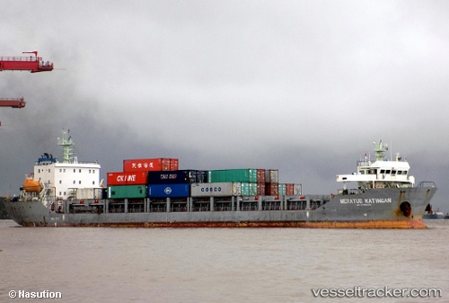
Meratus Katingan
Current StatusWhere is the vessel?
Meratus Katingan is currently in Near Jakarta, based on AIS data received less than 1h ago.
Latest AIS update:
Current position: 6.10357° S, 106.88798° E (Near Jakarta)
Average speed (last 7 days): Loading…
Average speed (last 30 days): Loading…
Vessel profile: Meratus Katingan is a Container Ship with dimensions 22m x 120m.
This page combines live AIS, route history, probable destination signals, nearby traffic, and port activity for practical vessel monitoring.
The current position of vessel Meratus Katingan is -6.10357 lat / 106.88798 lng. Updated: 2026-04-19 12:01:28 UTCNearest reference points:
- Near Jakarta
- Near Ancol
- Near New Priok Port
Details:
Live Vessel Meratus Katingan Analytics (details, animations, etc.)
Recent AIS points (UTC):
2026-04-19 08:17:27 UTC · -6.10352, 106.88795 · SOG 0 kn · COG 4°2026-04-19 10:05:17 UTC · -6.10355, 106.88796 · SOG 0 kn · COG -1°
2026-04-19 10:17:27 UTC · -6.10356, 106.88796 · SOG 0.1 kn · COG 3°
2026-04-19 12:01:28 UTC · -6.10357, 106.88798 · SOG 0.1 kn · COG -1°