 vesseltracker.com
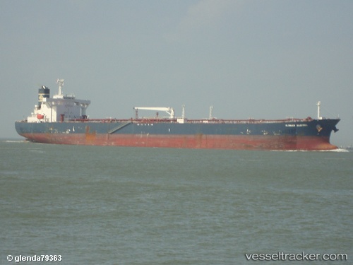
 Oceania
Current Status
Where is the vessel?
Oceania is currently in Near Busan, based on AIS data received about 7d ago.
Latest AIS update:
Current position: 35.07337° N, 129.07233° E (Near Busan)
Average speed (last 7 days): Loading…
Average speed (last 30 days): Loading…
Vessel profile: Oceania is a Crude Oil Tanker with dimensions 241m x 42m.
This page combines live AIS, route history, probable destination signals, nearby traffic, and port activity for practical vessel monitoring.
The current position of vessel Oceania is 35.07337 lat / 129.07233 lng. Updated: 2026-04-15 04:41:04 UTCNearest reference points:
- Near Busan
- Near Gamcheon/Busan
- Near BUSAN NEW PORT
Currently sailing under the flag of Indonesia ![]()
Oceania built in 2002 year
Deadweight:
106560 tDetails:
Live Vessel Oceania Analytics (details, animations, etc.)
Recent AIS points (UTC):
2026-04-15 04:41:04 UTC · 35.07337, 129.07233 · SOG 0 kn · COG -1°2026-04-15 04:41:04 UTC · 35.07337, 129.07233 · SOG 0 kn · COG -1°
2026-04-15 04:41:04 UTC · 35.07337, 129.07233 · SOG 0 kn · COG -1°