 vesseltracker.com
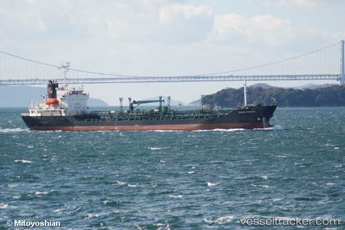
 ARAHAN
Current Status
Where is the vessel?
ARAHAN is currently in Near Tanjung Merangas, based on AIS data received about 3h ago.
Latest AIS update:
Current position: 0.17317° N, 117.49452° E (Near Tanjung Merangas)
Average speed (last 7 days): Loading…
Average speed (last 30 days): Loading…
Vessel profile: ARAHAN is a Oil/Chemical Tanker with dimensions m x m.
This page combines live AIS, route history, probable destination signals, nearby traffic, and port activity for practical vessel monitoring.
The current position of vessel ARAHAN is 0.17317 lat / 117.49452 lng. Updated: 2026-04-08 19:34:08 UTCNearest reference points:
- Near TANJUNG BARA
- Near Santan Terminal
- 16 nm SE of Santan Terminal
Currently sailing under the flag of Indonesia ![]()
Details:
Live Vessel ARAHAN Analytics (details, animations, etc.)
Recent AIS points (UTC):
2026-04-08 13:30:04 UTC · 0.17277, 117.49442 · SOG 1.2 kn · COG 70°2026-04-08 15:34:08 UTC · 0.17316, 117.49457 · SOG 0 kn · COG 90°
2026-04-08 17:28:09 UTC · 0.17316, 117.49454 · SOG 0.1 kn · COG 90°
2026-04-08 19:34:08 UTC · 0.17317, 117.49452 · SOG 0.1 kn · COG 90°