 vesseltracker.com
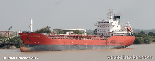
 WINSTON 01
Current Status
Where is the vessel?
WINSTON 01 is currently in 70 nm SE of Morowali, based on AIS data received about 20h ago.
Latest AIS update:
Current position: 2.79697° S, 122.20230° E (70 nm SE of Morowali)
Average speed (last 7 days): Loading…
Average speed (last 30 days): Loading…
Vessel profile: WINSTON 01 is a Oil Products Tanker with dimensions 25m x 100m.
This page combines live AIS, route history, probable destination signals, nearby traffic, and port activity for practical vessel monitoring.
The current position of vessel WINSTON 01 is -2.79697 lat / 122.20230 lng. Updated: 2026-04-10 07:49:54 UTCNearest reference points:
- 45 nm N of KENDARI
- 11 nm NW of KENDARI
- 22 nm S of Tangkiang
Currently sailing under the flag of Indonesia ![]()
WINSTON 01 built in 2010 year
Deadweight:
7064 tDetails:
Live Vessel WINSTON 01 Analytics (details, animations, etc.)
Recent AIS points (UTC):
2026-04-10 01:49:54 UTC · -2.79753, 122.20392 · SOG 0 kn · COG 295°2026-04-10 03:52:54 UTC · -2.79779, 122.20285 · SOG 0 kn · COG 21°
2026-04-10 05:34:54 UTC · -2.79696, 122.20247 · SOG 0 kn · COG 98°
2026-04-10 07:49:54 UTC · -2.79697, 122.20230 · SOG 0.1 kn · COG 80°