 vesseltracker.com
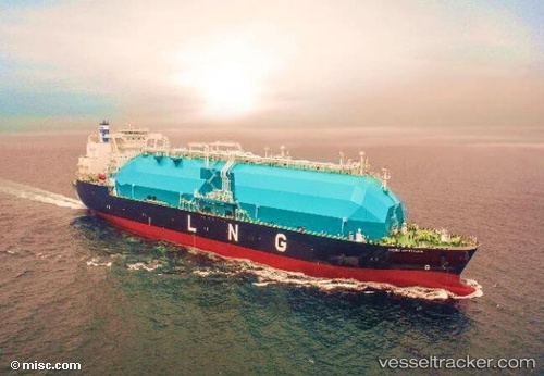
 Seri Cemara
Current Status
Where is the vessel?
Seri Cemara is currently in 42 nm NW of Tutong, based on AIS data received about 3h ago.
Latest AIS update:
Current position: 5.13485° N, 114.04043° E (42 nm NW of Tutong)
Average speed (last 7 days): Loading…
Average speed (last 30 days): Loading…
Vessel profile: Seri Cemara is a Lng Tanker with dimensions 290m x 49m.
This page combines live AIS, route history, probable destination signals, nearby traffic, and port activity for practical vessel monitoring.
The current position of vessel Seri Cemara is 5.13485 lat / 114.04043 lng. Updated: 2026-04-21 11:33:41 UTCNearest reference points:
- 11 nm N of MIRI
- Near MIRI
- Near Kikeh
Currently sailing under the flag of Malaysia ![]()
Details:
Live Vessel Seri Cemara Analytics (details, animations, etc.)
Recent AIS points (UTC):
2026-04-21 10:21:28 UTC · 5.30748, 114.26451 · SOG 13.9 kn · COG 236°2026-04-21 11:33:41 UTC · 5.13485, 114.04043 · SOG 13.9 kn · COG 232°
2026-04-21 11:33:41 UTC · 5.13485, 114.04043 · SOG 13.9 kn · COG 232°
2026-04-21 11:33:41 UTC · 5.13485, 114.04043 · SOG 13.9 kn · COG 232°