 vesseltracker.com
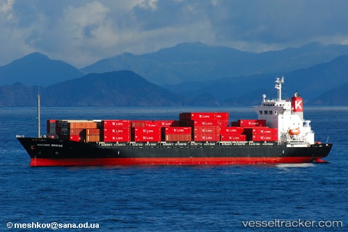
Danum 171
Current StatusWhere is the vessel?
Danum 171 is currently in Near Yangpu Pt, based on AIS data received less than 1h ago.
Latest AIS update:
Current position: 19.71586° N, 109.17329° E (Near Yangpu Pt)
Average speed (last 7 days): Loading…
Average speed (last 30 days): Loading…
Vessel profile: Danum 171 is a Container Ship with dimensions 25m x 146m.
This page combines live AIS, route history, probable destination signals, nearby traffic, and port activity for practical vessel monitoring.
The current position of vessel Danum 171 is 19.71586 lat / 109.17329 lng. Updated: 2026-04-02 06:01:35 UTCNearest reference points:
- Near Yangpu Pt
- Near Baimajing
- 10 nm W of Yangpu Pt
Details:
Live Vessel Danum 171 Analytics (details, animations, etc.)
Recent AIS points (UTC):
2026-04-01 23:52:40 UTC · 19.71587, 109.17334 · SOG 0.1 kn · COG 43°2026-04-02 02:25:35 UTC · 19.71587, 109.17340 · SOG 0 kn · COG 44°
2026-04-02 03:28:35 UTC · 19.71582, 109.17346 · SOG 0 kn · COG 44°
2026-04-02 06:01:35 UTC · 19.71586, 109.17329 · SOG 0 kn · COG 44°