 vesseltracker.com
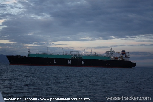
 Seri Angkasa
Current Status
Where is the vessel?
Seri Angkasa is currently in Near GLADSTONE, based on AIS data received about 2h ago.
Latest AIS update:
Current position: 23.80524° S, 151.22514° E (Near GLADSTONE)
Average speed (last 7 days): Loading…
Average speed (last 30 days): Loading…
Vessel profile: Seri Angkasa is a Lng Tanker with dimensions 282m x 284m.
This page combines live AIS, route history, probable destination signals, nearby traffic, and port activity for practical vessel monitoring.
The current position of vessel Seri Angkasa is -23.80524 lat / 151.22514 lng. Updated: 2026-04-21 05:27:59 UTCNearest reference points:
- Near Gladstone Harbor
- Near Boyne Island
- Near ROSSLYN
Currently sailing under the flag of Malaysia ![]()
Seri Angkasa built in 2006 year
Deadweight:
83407 tDetails:
Live Vessel Seri Angkasa Analytics (details, animations, etc.)
Recent AIS points (UTC):
2026-04-21 01:59:59 UTC · -23.81858, 151.64873 · SOG 7.6 kn · COG 287°2026-04-21 04:15:49 UTC · -23.89335, 151.37926 · SOG 12.6 kn · COG 301°
2026-04-21 04:24:10 UTC · -23.87548, 151.35498 · SOG 12 kn · COG 315°
2026-04-21 05:27:59 UTC · -23.80524, 151.22514 · SOG 7.2 kn · COG 295°