 vesseltracker.com
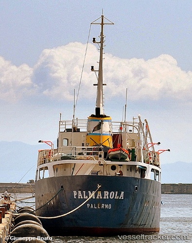
 Palmarola
Current Status
Where is the vessel?
Palmarola is currently in Near Gaeta, based on AIS data received about 1h ago.
Latest AIS update:
Current position: 41.23187° N, 13.56967° E (Near Gaeta)
Average speed (last 7 days): Loading…
Average speed (last 30 days): Loading…
Vessel profile: Palmarola is a Water Tanker with dimensions 62m x 9m.
This page combines live AIS, route history, probable destination signals, nearby traffic, and port activity for practical vessel monitoring.
The current position of vessel Palmarola is 41.23187 lat / 13.56967 lng. Updated: 2026-04-18 21:42:56 UTCNearest reference points:
- Near Gaeta
- Near Naples
- Near MERGELLINA
Currently sailing under the flag of Italy ![]()
Palmarola built in 1962 year
Deadweight:
899 tDetails:
Live Vessel Palmarola Analytics (details, animations, etc.)
Recent AIS points (UTC):
2026-04-18 16:20:20 UTC · 41.04315, 13.34905 · SOG 7.6 kn · COG -1°2026-04-18 17:35:34 UTC · 41.12568, 13.52023 · SOG 7.2 kn · COG -1°
2026-04-18 19:21:48 UTC · 41.23183, 13.56973 · SOG 0 kn · COG -1°
2026-04-18 21:42:56 UTC · 41.23187, 13.56967 · SOG 0 kn · COG -1°