 vesseltracker.com
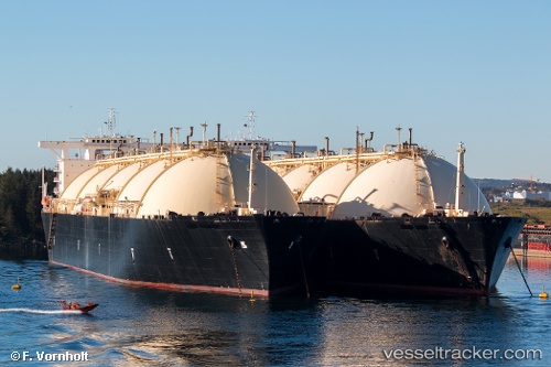
 Gulf Energy
Current Status
Where is the vessel?
Gulf Energy is currently in Near Bøneset - Karmøy, based on AIS data received less than 1h ago.
Latest AIS update:
Current position: 59.35908° N, 5.29983° E (Near Bøneset - Karmøy)
Average speed (last 7 days): Loading…
Average speed (last 30 days): Loading…
Vessel profile: Gulf Energy is a Lng Tanker with dimensions 285m x 44m.
This page combines live AIS, route history, probable destination signals, nearby traffic, and port activity for practical vessel monitoring.
The current position of vessel Gulf Energy is 59.35908 lat / 5.29983 lng. Updated: 2026-04-10 03:47:12 UTCNearest reference points:
- Near HUSOYA
- Near Storøya
- Near Valevåg
Currently sailing under the flag of Marshall Is ![]()
Gulf Energy built in 1978 year
Deadweight:
72472 tDetails:
Live Vessel Gulf Energy Analytics (details, animations, etc.)
Recent AIS points (UTC):
2026-04-09 21:59:26 UTC · 59.35907, 5.29991 · SOG 0 kn · COG -1°2026-04-10 00:17:14 UTC · 59.35908, 5.29994 · SOG 0 kn · COG -1°
2026-04-10 02:23:15 UTC · 59.35907, 5.29986 · SOG 0 kn · COG -1°
2026-04-10 03:47:12 UTC · 59.35908, 5.29983 · SOG 0 kn · COG -1°