 vesseltracker.com
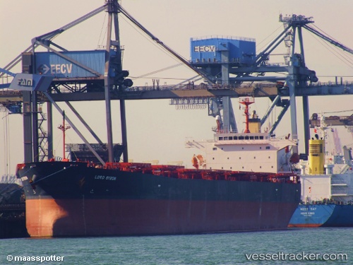
Lord Byron
Current StatusWhere is the vessel?
Lord Byron is currently in 45 nm E of ZHOUSHAN, based on AIS data received about 1h ago.
Latest AIS update:
Current position: 29.72357° N, 123.01123° E (45 nm E of ZHOUSHAN)
Average speed (last 7 days): Loading…
Average speed (last 30 days): Loading…
Vessel profile: Lord Byron is a Bulk Carrier with dimensions 32m x 225m.
This page combines live AIS, route history, probable destination signals, nearby traffic, and port activity for practical vessel monitoring.
The current position of vessel Lord Byron is 29.72357 lat / 123.01123 lng. Updated: 2026-03-31 05:39:59 UTCNearest reference points:
- 44 nm E of ZHOUSHAN
- 50 nm E of ZHOUSHAN
- 41 nm SE of ZHOUSHAN
Details:
Live Vessel Lord Byron Analytics (details, animations, etc.)
Recent AIS points (UTC):
2026-03-30 23:41:27 UTC · 29.72462, 123.01040 · SOG 0.1 kn · COG 36°2026-03-31 02:00:59 UTC · 29.72463, 123.00937 · SOG 0.2 kn · COG 48°
2026-03-31 04:04:28 UTC · 29.72357, 123.01080 · SOG 0 kn · COG -1°
2026-03-31 05:39:59 UTC · 29.72357, 123.01123 · SOG 0 kn · COG 17°