 vesseltracker.com
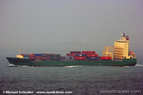
Cape Flores
Current StatusWhere is the vessel?
Cape Flores is currently in 19 nm E of Beira, based on AIS data received about 4h ago.
Latest AIS update:
Current position: 19.94078° S, 35.13484° E (19 nm E of Beira)
Average speed (last 7 days): Loading…
Average speed (last 30 days): Loading…
Vessel profile: Cape Flores is a Container Ship with dimensions 24m x 154m.
This page combines live AIS, route history, probable destination signals, nearby traffic, and port activity for practical vessel monitoring.
The current position of vessel Cape Flores is -19.94078 lat / 35.13484 lng. Updated: 2026-04-10 07:41:44 UTCNearest reference points:
- 21 nm SE of Beira
- 14 nm E of Beira
- 24 nm SE of Beira
Details:
Live Vessel Cape Flores Analytics (details, animations, etc.)
Recent AIS points (UTC):
2026-04-10 02:14:44 UTC · -19.94086, 35.13343 · SOG 0.2 kn · COG 150°2026-04-10 03:59:44 UTC · -19.94085, 35.13355 · SOG 0 kn · COG 153°
2026-04-10 05:35:44 UTC · -19.94075, 35.13463 · SOG 0.1 kn · COG 185°
2026-04-10 07:41:44 UTC · -19.94078, 35.13484 · SOG 0.2 kn · COG 191°