 vesseltracker.com
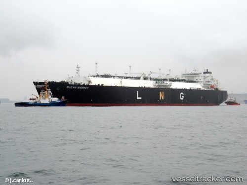
Clean Energy
Current StatusWhere is the vessel?
Clean Energy is currently in Near HAMBANTOTA, based on AIS data received less than 1h ago.
Latest AIS update:
Current position: 6.13115° N, 81.08847° E (Near HAMBANTOTA)
Average speed (last 7 days): Loading…
Average speed (last 30 days): Loading…
Vessel profile: Clean Energy is a Lng Tanker with dimensions 44m x 288m.
This page combines live AIS, route history, probable destination signals, nearby traffic, and port activity for practical vessel monitoring.
The current position of vessel Clean Energy is 6.13115 lat / 81.08847 lng. Updated: 2026-04-20 19:28:40 UTCNearest reference points:
- Near HAMBANTOTA
- 15 nm S of Koggala
- 40 nm E of Konwelana
Details:
Live Vessel Clean Energy Analytics (details, animations, etc.)
Recent AIS points (UTC):
2026-04-20 16:19:42 UTC · 6.13113, 81.08842 · SOG 0 kn · COG 0°2026-04-20 18:04:43 UTC · 6.13116, 81.08840 · SOG 0 kn · COG 0°
2026-04-20 19:19:42 UTC · 6.13112, 81.08841 · SOG 0 kn · COG 0°
2026-04-20 19:28:40 UTC · 6.13115, 81.08847 · SOG 0 kn · COG 0°