 vesseltracker.com
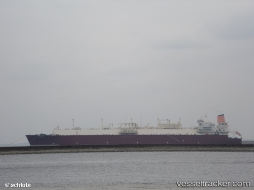
 Al Hamla
Current Status
Where is the vessel?
Al Hamla is currently in 51 nm S of Keti Bandar, based on AIS data received less than 1h ago.
Latest AIS update:
Current position: 23.33220° N, 67.09846° E (51 nm S of Keti Bandar)
Average speed (last 7 days): Loading…
Average speed (last 30 days): Loading…
Vessel profile: Al Hamla is a Lng Tanker with dimensions 315m x 50m.
This page combines live AIS, route history, probable destination signals, nearby traffic, and port activity for practical vessel monitoring.
The current position of vessel Al Hamla is 23.33220 lat / 67.09846 lng. Updated: 2026-04-01 16:21:10 UTCNearest reference points:
- 84 nm SW of Keti Bandar
- 16 nm S of Kiamari
- Near PORT QASIM
Currently sailing under the flag of Marshall Is ![]()
Al Hamla built in 2008 year
Deadweight:
107514 tDetails:
Live Vessel Al Hamla Analytics (details, animations, etc.)
Recent AIS points (UTC):
2026-04-01 09:27:01 UTC · 24.45215, 66.92334 · SOG 0 kn · COG -1°2026-04-01 12:22:53 UTC · 24.31942, 66.98257 · SOG 15.4 kn · COG 154°
2026-04-01 13:37:45 UTC · 24.01005, 66.97384 · SOG 14.9 kn · COG 182°
2026-04-01 16:21:10 UTC · 23.33220, 67.09846 · SOG 15.3 kn · COG 171°