 vesseltracker.com
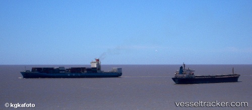
 WADI BANI KHALID
Current Status
Where is the vessel?
WADI BANI KHALID is currently in 33 nm S of Nudao, based on AIS data received about 1d ago.
Latest AIS update:
Current position: 35.83841° N, 120.91676° E (33 nm S of Nudao)
Average speed (last 7 days): Loading…
Average speed (last 30 days): Loading…
Vessel profile: WADI BANI KHALID is a Container Ship with dimensions 260m x 32m.
This page combines live AIS, route history, probable destination signals, nearby traffic, and port activity for practical vessel monitoring.
The current position of vessel WADI BANI KHALID is 35.83841 lat / 120.91676 lng. Updated: 2026-04-10 08:20:51 UTCNearest reference points:
- 36 nm SE of Qingdao
- 26 nm S of Nudao
- 43 nm SE of Qingdao
Currently sailing under the flag of Marshall Islands ![]()
WADI BANI KHALID built in 2008 year
Deadweight:
50596 tDetails:
Live Vessel WADI BANI KHALID Analytics (details, animations, etc.)
Recent AIS points (UTC):
2026-04-10 01:50:52 UTC · 35.83502, 120.91393 · SOG 0.1 kn · COG 18°2026-04-10 03:53:51 UTC · 35.83548, 120.91687 · SOG 0.2 kn · COG 311°
2026-04-10 05:44:53 UTC · 35.83792, 120.91709 · SOG 0 kn · COG 233°
2026-04-10 08:20:51 UTC · 35.83841, 120.91676 · SOG 0.1 kn · COG 221°