 vesseltracker.com
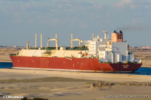
 Al Samriya
Current Status
Where is the vessel?
Al Samriya is currently in 146 nm E of Abakaliki, based on AIS data received about 4h ago.
Latest AIS update:
Current position: 5.79167° N, 88.38167° E (146 nm E of Abakaliki)
Average speed (last 7 days): Loading…
Average speed (last 30 days): Loading…
Vessel profile: Al Samriya is a Lng Tanker with dimensions 345m x 345m.
This page combines live AIS, route history, probable destination signals, nearby traffic, and port activity for practical vessel monitoring.
The current position of vessel Al Samriya is 5.79167 lat / 88.38167 lng. Updated: 2026-04-08 16:00:29 UTCNearest reference points:
- 243 nm E of Abakaliki
- 23 nm S of Abakaliki
Currently sailing under the flag of Marshall Is ![]()
Al Samriya built in 2009 year
Deadweight:
154900 tDetails:
Live Vessel Al Samriya Analytics (details, animations, etc.)
Recent AIS points (UTC):
2026-04-08 12:19:07 UTC · 5.72884, 89.35008 · SOG 16 kn · COG 271°2026-04-08 14:16:44 UTC · 5.77898, 88.83451 · SOG 15.9 kn · COG 271°
2026-04-08 15:45:25 UTC · 5.79333, 88.44667 · SOG 15 kn · COG -1°
2026-04-08 16:00:29 UTC · 5.79167, 88.38167 · SOG 16 kn · COG -1°