 vesseltracker.com
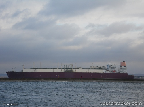
 Al Nuaman
Current Status
Where is the vessel?
Al Nuaman is currently in 349 nm N of ANEGADA, based on AIS data received about 1h ago.
Latest AIS update:
Current position: 24.52333° N, 64.07833° W (349 nm N of ANEGADA)
Average speed (last 7 days): Loading…
Average speed (last 30 days): Loading…
Vessel profile: Al Nuaman is a Lng Tanker with dimensions 315m x 50m.
This page combines live AIS, route history, probable destination signals, nearby traffic, and port activity for practical vessel monitoring.
The current position of vessel Al Nuaman is 24.52333 lat / -64.07833 lng. Updated: 2026-04-18 19:45:26 UTCNearest reference points:
- 361 nm W of Villa Elisa
- Open sea, approx. 420 nm off the nearest listed port
- Open sea, approx. 412 nm off the nearest listed port
Currently sailing under the flag of Marshall Is ![]()
Al Nuaman built in 2009 year
Deadweight:
121910 tDetails:
Live Vessel Al Nuaman Analytics (details, animations, etc.)
Recent AIS points (UTC):
2026-04-18 13:54:22 UTC · 24.88333, -62.49833 · SOG 15 kn · COG -1°2026-04-18 16:15:23 UTC · 24.73667, -63.14167 · SOG 15 kn · COG -1°
2026-04-18 17:42:23 UTC · 24.65167, -63.53167 · SOG 15 kn · COG -1°
2026-04-18 19:45:26 UTC · 24.52333, -64.07833 · SOG 15 kn · COG -1°