 vesseltracker.com
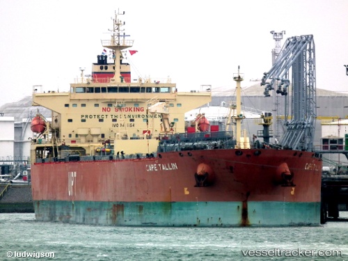
 Cape Tallin
Current Status
Where is the vessel?
Cape Tallin is currently in Near Mamonal, based on AIS data received less than 1h ago.
Latest AIS update:
Current position: 10.30062° N, 75.55951° W (Near Mamonal)
Average speed (last 7 days): Loading…
Average speed (last 30 days): Loading…
Vessel profile: Cape Tallin is a Crude Oil Tanker with dimensions 228m x 32m.
This page combines live AIS, route history, probable destination signals, nearby traffic, and port activity for practical vessel monitoring.
The current position of vessel Cape Tallin is 10.30062 lat / -75.55951 lng. Updated: 2026-04-19 11:58:20 UTCNearest reference points:
- Near Contecar
- Near Sociedad Portuaria Regional Cartagena
- Near Santa Marta
Currently sailing under the flag of Marshall Is ![]()
Cape Tallin built in 2008 year
Deadweight:
73711 tDetails:
Live Vessel Cape Tallin Analytics (details, animations, etc.)
Recent AIS points (UTC):
2026-04-19 07:55:25 UTC · 10.30009, -75.55858 · SOG 0 kn · COG 1°2026-04-19 09:40:30 UTC · 10.30030, -75.55912 · SOG 0 kn · COG 24°
2026-04-19 10:04:16 UTC · 10.30033, -75.55909 · SOG 0 kn · COG 23°
2026-04-19 11:58:20 UTC · 10.30062, -75.55951 · SOG 0 kn · COG 33°