 vesseltracker.com
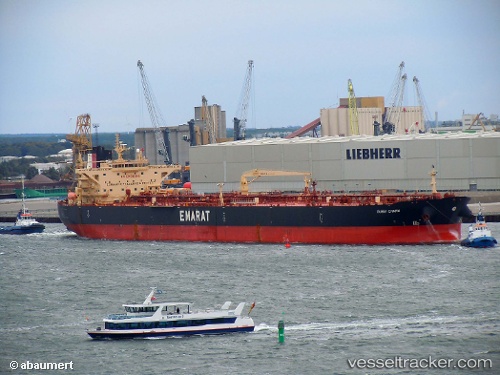
Dubai Charm
Current StatusWhere is the vessel?
Dubai Charm is currently in Near Trainer, based on AIS data received about 19h ago.
Latest AIS update:
Current position: 39.80981° N, 75.39876° W (Near Trainer)
Average speed (last 7 days): Loading…
Average speed (last 30 days): Loading…
Vessel profile: Dubai Charm is a Crude Oil Tanker with dimensions 42m x 250m.
This page combines live AIS, route history, probable destination signals, nearby traffic, and port activity for practical vessel monitoring.
The current position of vessel Dubai Charm is 39.80981 lat / -75.39876 lng. Updated: 2026-04-10 07:44:41 UTCNearest reference points:
- Near Trainer
- Near Wilmington
- Near Brooklawn
Details:
Live Vessel Dubai Charm Analytics (details, animations, etc.)
Recent AIS points (UTC):
2026-04-10 02:20:38 UTC · 39.80656, -75.40307 · SOG 0 kn · COG 65°2026-04-10 04:14:39 UTC · 39.80661, -75.40322 · SOG 0.1 kn · COG 67°
2026-04-10 06:28:44 UTC · 39.80707, -75.40254 · SOG 0.1 kn · COG 59°
2026-04-10 07:44:41 UTC · 39.80981, -75.39876 · SOG 0.1 kn · COG 232°