 vesseltracker.com
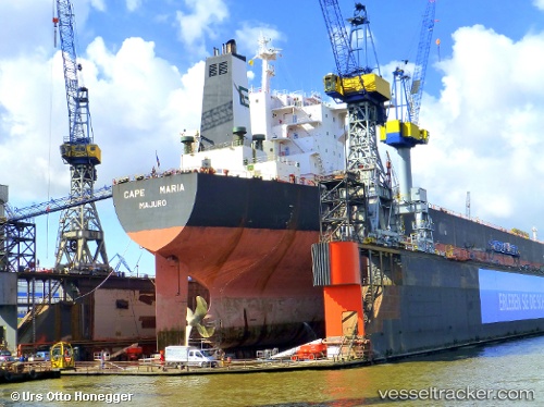
Cape Maria
Current StatusWhere is the vessel?
Cape Maria is currently in Open sea, approx. 478 nm off the nearest listed port, based on AIS data received less than 1h ago.
Latest AIS update:
Current position: 3.36625° S, 7.81543° W (Open sea, approx. 478 nm off the nearest listed port)
Average speed (last 7 days): Loading…
Average speed (last 30 days): Loading…
Vessel profile: Cape Maria is a Bulk Carrier with dimensions 47m x 289m.
This page combines live AIS, route history, probable destination signals, nearby traffic, and port activity for practical vessel monitoring.
The current position of vessel Cape Maria is -3.36625 lat / -7.81543 lng. Updated: 2026-04-19 16:16:25 UTCNearest reference points:
- Open sea, approx. 478 nm off the nearest listed port
- Open sea, approx. 476 nm off the nearest listed port
- Open sea, approx. 475 nm off the nearest listed port
Details:
Live Vessel Cape Maria Analytics (details, animations, etc.)
Recent AIS points (UTC):
2026-04-19 13:40:45 UTC · -3.02667, -8.05667 · SOG 9 kn · COG -1°2026-04-19 14:18:44 UTC · -3.11097, -7.99682 · SOG 9.8 kn · COG 140°
2026-04-19 16:00:24 UTC · -3.33367, -7.84137 · SOG 9.4 kn · COG 140°
2026-04-19 16:16:25 UTC · -3.36625, -7.81543 · SOG 9.4 kn · COG 138°