 vesseltracker.com
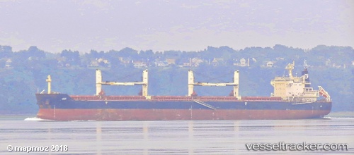
Jay
Current StatusWhere is the vessel?
Jay is currently in 43 nm SE of San Clodio, based on AIS data received about 2h ago.
Latest AIS update:
Current position: 47.93667° N, 6.58333° W (43 nm SE of San Clodio)
Average speed (last 7 days): Loading…
Average speed (last 30 days): Loading…
Vessel profile: Jay is a Bulk Carrier with dimensions 32m x 190m.
This page combines live AIS, route history, probable destination signals, nearby traffic, and port activity for practical vessel monitoring.
The current position of vessel Jay is 47.93667 lat / -6.58333 lng. Updated: 2026-03-31 07:05:54 UTCNearest reference points:
- 60 nm SE of San Clodio
- 35 nm SW of Ile D’Ouessant
- 46 nm W of SEIN
Details:
Live Vessel Jay Analytics (details, animations, etc.)
Recent AIS points (UTC):
2026-03-31 02:15:34 UTC · 48.70158, -5.93254 · SOG 9.3 kn · COG 208°2026-03-31 03:14:33 UTC · 48.56105, -6.04315 · SOG 9.8 kn · COG 216°
2026-03-31 06:01:59 UTC · 48.12048, -6.42065 · SOG 11.8 kn · COG 213°
2026-03-31 07:05:54 UTC · 47.93667, -6.58333 · SOG 12 kn · COG -1°