 vesseltracker.com
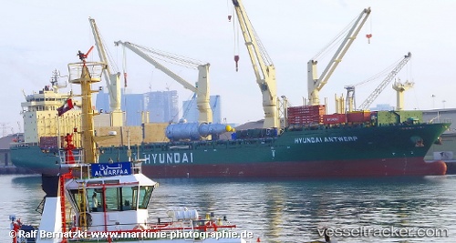
Hyundai Antwerp
Current StatusWhere is the vessel?
Hyundai Antwerp is currently in 302 nm SE of Santa Venera, based on AIS data received about 2h ago.
Latest AIS update:
Current position: 32.53167° N, 147.92667° E (302 nm SE of Santa Venera)
Average speed (last 7 days): Loading…
Average speed (last 30 days): Loading…
Vessel profile: Hyundai Antwerp is a Multi Purpose Carrier with dimensions 28m x 193m.
This page combines live AIS, route history, probable destination signals, nearby traffic, and port activity for practical vessel monitoring.
The current position of vessel Hyundai Antwerp is 32.53167 lat / 147.92667 lng. Updated: 2026-04-08 15:55:26 UTCNearest reference points:
- 388 nm NE of Omura
- Open sea, approx. 400 nm off the nearest listed port
- Open sea, approx. 407 nm off the nearest listed port
Details:
Live Vessel Hyundai Antwerp Analytics (details, animations, etc.)
Recent AIS points (UTC):
2026-04-08 12:10:27 UTC · 32.39833, 147.03667 · SOG 12 kn · COG -1°2026-04-08 13:49:28 UTC · 32.45833, 147.42500 · SOG 12 kn · COG -1°
2026-04-08 15:55:26 UTC · 32.53167, 147.92667 · SOG 12 kn · COG -1°
2026-04-08 15:55:26 UTC · 32.53167, 147.92667 · SOG 12 kn · COG -1°