 vesseltracker.com
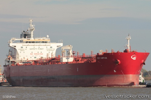
 Sti Virtus
Current Status
Where is the vessel?
Sti Virtus is currently in 62 nm S of Liberdade, based on AIS data received about 3h ago.
Latest AIS update:
Current position: 12.05520° S, 126.44452° E (62 nm S of Liberdade)
Average speed (last 7 days): Loading…
Average speed (last 30 days): Loading…
Vessel profile: Sti Virtus is a Chemical Oil Products Tanker with dimensions 183m x 32m.
This page combines live AIS, route history, probable destination signals, nearby traffic, and port activity for practical vessel monitoring.
The current position of vessel Sti Virtus is -12.05520 lat / 126.44452 lng. Updated: 2026-04-14 23:44:02 UTCNearest reference points:
- 65 nm E of Front Puffin FPSO
Currently sailing under the flag of Marshall Is ![]()
Sti Virtus built in 2014 year
Deadweight:
52000 tDetails:
Live Vessel Sti Virtus Analytics (details, animations, etc.)
Recent AIS points (UTC):
2026-04-14 17:09:17 UTC · -12.14318, 127.88310 · SOG 12.1 kn · COG 277°2026-04-14 20:10:59 UTC · -12.09597, 127.23912 · SOG 13 kn · COG 273°
2026-04-14 22:06:28 UTC · -12.06927, 126.80830 · SOG 13.3 kn · COG 273°
2026-04-14 23:44:02 UTC · -12.05520, 126.44452 · SOG 13.1 kn · COG 275°