 vesseltracker.com
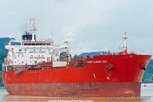
Saint Albans Bay
Current StatusWhere is the vessel?
Saint Albans Bay is currently in Near QUINTERO, based on AIS data received less than 1h ago.
Latest AIS update:
Current position: 32.76235° S, 71.49444° W (Near QUINTERO)
Average speed (last 7 days): Loading…
Average speed (last 30 days): Loading…
Vessel profile: Saint Albans Bay is a Chemical Oil Products Tanker with dimensions 32m x 183m.
This page combines live AIS, route history, probable destination signals, nearby traffic, and port activity for practical vessel monitoring.
The current position of vessel Saint Albans Bay is -32.76235 lat / -71.49444 lng. Updated: 2026-04-12 13:36:32 UTCNearest reference points:
- Near Valparaiso
- 28 nm W of Pichilemu
- 100 nm W of Curauma
Details:
Live Vessel Saint Albans Bay Analytics (details, animations, etc.)
Recent AIS points (UTC):
2026-04-12 07:39:32 UTC · -32.76232, -71.49447 · SOG 0.1 kn · COG 293°2026-04-12 09:42:32 UTC · -32.76232, -71.49442 · SOG 0 kn · COG 294°
2026-04-12 12:09:32 UTC · -32.76231, -71.49448 · SOG 0.1 kn · COG 294°
2026-04-12 13:36:32 UTC · -32.76235, -71.49444 · SOG 0 kn · COG 293°