 vesseltracker.com
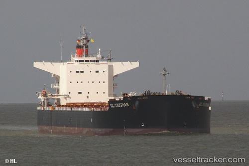
 Amami
Amami
Current Status
Where is the vessel?
Amami is currently in 195 nm E of Kings Bromley, based on AIS data received less than 1h ago.
Latest AIS update:
Current position: 52.46891° N, 143.65932° W (195 nm E of Kings Bromley)
Average speed (last 7 days): Loading…
Average speed (last 30 days): Loading…
Vessel profile: Amami is a Bulk Carrier with dimensions 240m x 240m.
This page combines live AIS, route history, probable destination signals, nearby traffic, and port activity for practical vessel monitoring.
The current position of vessel Amami is 52.46891 lat / -143.65932 lng. Updated: 2026-03-31 01:28:07 UTCCurrently sailing under the flag of Marshall Is ![]()
Amami built in 2011 year
Deadweight:
98681 tDetails:
Live Vessel Amami Analytics (details, animations, etc.)
Recent AIS points (UTC):
2026-03-30 19:27:07 UTC · 52.41500, -142.66167 · SOG 5 kn · COG -1°2026-03-30 21:41:39 UTC · 52.43485, -142.97993 · SOG 6.1 kn · COG 265°
2026-03-31 00:00:08 UTC · 52.45833, -143.37500 · SOG 7 kn · COG -1°
2026-03-31 01:28:07 UTC · 52.46891, -143.65932 · SOG 6.6 kn · COG 270°