 vesseltracker.com
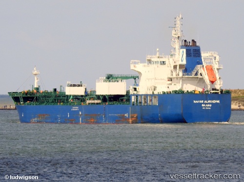
 Navig8 Almandine
Current Status
Where is the vessel?
Navig8 Almandine is currently in 33 nm E of NANTUCKET, based on AIS data received about 1h ago.
Latest AIS update:
Current position: 41.40060° N, 69.37064° W (33 nm E of NANTUCKET)
Average speed (last 7 days): Loading…
Average speed (last 30 days): Loading…
Vessel profile: Navig8 Almandine is a Chemical Oil Products Tanker with dimensions 184m x 184m.
This page combines live AIS, route history, probable destination signals, nearby traffic, and port activity for practical vessel monitoring.
The current position of vessel Navig8 Almandine is 41.40060 lat / -69.37064 lng. Updated: 2026-04-19 16:05:28 UTCNearest reference points:
- 28 nm SE of East Harwich
- Near South Yarmouth
- Near Barnstable
Currently sailing under the flag of Marshall Is ![]()
Details:
Live Vessel Navig8 Almandine Analytics (details, animations, etc.)
Recent AIS points (UTC):
2026-04-19 12:44:59 UTC · 40.92667, -69.05167 · SOG 13 kn · COG -1°2026-04-19 13:26:59 UTC · 41.04667, -69.13833 · SOG 8 kn · COG -1°
2026-04-19 15:45:45 UTC · 41.35667, -69.34500 · SOG 7 kn · COG -1°
2026-04-19 16:05:28 UTC · 41.40060, -69.37064 · SOG 9.5 kn · COG 334°