 vesseltracker.com
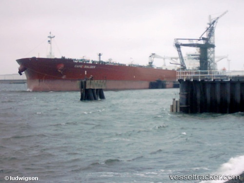
 Cape Balder
Current Status
Where is the vessel?
Cape Balder is currently in 16 nm NE of Lü-hua Shan, based on AIS data received about 343d ago.
Latest AIS update:
Current position: 30.96472° N, 122.87312° E (16 nm NE of Lü-hua Shan)
Average speed (last 7 days): Loading…
Average speed (last 30 days): Loading…
Vessel profile: Cape Balder is a Crude Oil Tanker with dimensions 274m x 48m.
This page combines live AIS, route history, probable destination signals, nearby traffic, and port activity for practical vessel monitoring.
The current position of vessel Cape Balder is 30.96472 lat / 122.87312 lng. Updated: 2025-05-01 17:11:55 UTCNearest reference points:
- 19 nm NE of Lü-hua Shan
- 21 nm NE of Lü-hua Shan
- 14 nm N of Lü-hua Shan
Currently sailing under the flag of Marshall Is ![]()
Cape Balder built in 2000 year
Deadweight:
159998 tDetails:
Live Vessel Cape Balder Analytics (details, animations, etc.)
Recent AIS points (UTC):
2025-05-01 17:11:55 UTC · 30.96472, 122.87312 · SOG 12.7 kn · COG 84°