 vesseltracker.com
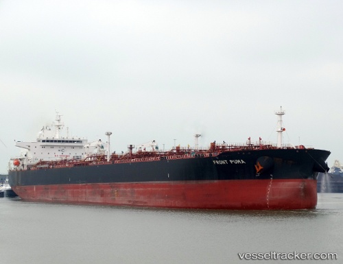
 SFL PUMA
Current Status
Where is the vessel?
SFL PUMA is currently in 69 nm S of Porsuk, based on AIS data received about 1d ago.
Latest AIS update:
Current position: 1.10073° S, 0.39180° W (69 nm S of Porsuk)
Average speed (last 7 days): Loading…
Average speed (last 30 days): Loading…
Vessel profile: SFL PUMA is a Crude Oil Tanker with dimensions m x m.
This page combines live AIS, route history, probable destination signals, nearby traffic, and port activity for practical vessel monitoring.
The current position of vessel SFL PUMA is -1.10073 lat / -0.39180 lng. Updated: 2026-04-10 07:34:54 UTCNearest reference points:
- Near Porsuk
- Near SAO LUIS
- 66 nm N of SAO LUIS
Currently sailing under the flag of Marshall Islands ![]()
SFL PUMA built in 2015 year
Deadweight:
99993 tDetails:
Live Vessel SFL PUMA Analytics (details, animations, etc.)
Recent AIS points (UTC):
2026-04-10 02:26:59 UTC · -1.72977, 0.62046 · SOG 13.6 kn · COG 299°2026-04-10 03:43:44 UTC · -1.57542, 0.36917 · SOG 13.8 kn · COG 297°
2026-04-10 05:20:51 UTC · -1.37532, 0.04941 · SOG 13.8 kn · COG 300°
2026-04-10 07:34:54 UTC · -1.10073, -0.39180 · SOG 14 kn · COG 299°