 vesseltracker.com
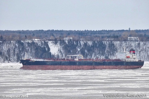
Vessel Brook Trout IMO: 9314181, MMSI: 538006217 Crude Oil Tanker
UTC, 22.38333, -86.13500, course: -1, speed: 14
UTC, 22.76833, -86.40667, course: -1, speed: 14
2026-02-25 00:21:06 UTC, 23.41833, -86.83833, course: -1, speed: 16
Live AIS position:
UTC. 130 nm N of ISLA MUJERES),
updated 2026-02-25 00:21:06 UTC.
Find the position of the vessel Brook Trout on the map. The latter are known coordinates and path.
marine traffic ship tracker show on live map
The current position of vessel Brook Trout is 23.41833 lat / -86.83833 lng. Updated: 2026-02-25 00:21:06 UTCDetails:
Last coordinates of the vessel:
UTC, 22.04650, -85.89359, course: -1, speed: 13.8UTC, 22.38333, -86.13500, course: -1, speed: 14
UTC, 22.76833, -86.40667, course: -1, speed: 14
2026-02-25 00:21:06 UTC, 23.41833, -86.83833, course: -1, speed: 16