 vesseltracker.com
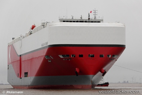
Hawaiian Highway
Current StatusWhere is the vessel?
Hawaiian Highway is currently in 18 nm NW of Dunkerque, based on AIS data received about 1h ago.
Latest AIS update:
Current position: 51.31201° N, 2.11544° E (18 nm NW of Dunkerque)
Average speed (last 7 days): Loading…
Average speed (last 30 days): Loading…
Vessel profile: Hawaiian Highway is a Vehicles Carrier with dimensions 40m x 199m.
This page combines live AIS, route history, probable destination signals, nearby traffic, and port activity for practical vessel monitoring.
The current position of vessel Hawaiian Highway is 51.31201 lat / 2.11544 lng. Updated: 2026-04-02 09:57:48 UTCNearest reference points:
- 15 nm E of RAMSGATE
- Near Dunkerque
- 14 nm SE of RAMSGATE
Details:
Live Vessel Hawaiian Highway Analytics (details, animations, etc.)
Recent AIS points (UTC):
2026-04-02 03:45:48 UTC · 50.55201, 1.04339 · SOG 11.7 kn · COG 49°2026-04-02 05:50:24 UTC · 50.84645, 1.42138 · SOG 10.2 kn · COG 15°
2026-04-02 08:19:28 UTC · 51.12671, 1.82388 · SOG 9.1 kn · COG 49°
2026-04-02 09:57:48 UTC · 51.31201, 2.11544 · SOG 10.8 kn · COG 5°