 vesseltracker.com
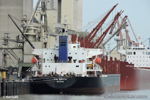
 Tia Marta
Current Status
Where is the vessel?
Tia Marta is currently in 42 nm SW of Bata, based on AIS data received about 111d ago.
Latest AIS update:
Current position: 1.41644° N, 9.22481° E (42 nm SW of Bata)
Average speed (last 7 days): Loading…
Average speed (last 30 days): Loading…
Vessel profile: Tia Marta is a Bulk Carrier with dimensions 180m x 30m.
This page combines live AIS, route history, probable destination signals, nearby traffic, and port activity for practical vessel monitoring.
The current position of vessel Tia Marta is 1.41644 lat / 9.22481 lng. Updated: 2025-12-20 11:48:34 UTCNearest reference points:
- Near Cape Lopez
- Near Port Gentil
- 12 nm SE of Okono
Currently sailing under the flag of Marshall Is ![]()
Details:
Live Vessel Tia Marta Analytics (details, animations, etc.)
Recent AIS points (UTC):
2025-12-20 11:48:34 UTC · 1.41644, 9.22481 · SOG 6.6 kn · COG -1°