 vesseltracker.com
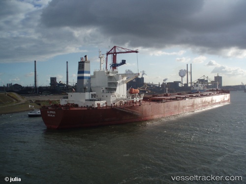
 GLORIUSHIP
Current Status
Where is the vessel?
GLORIUSHIP is currently in Near Port Said East, based on AIS data received about 15h ago.
Latest AIS update:
Current position: 31.08832° N, 32.30850° E (Near Port Said East)
Average speed (last 7 days): Loading…
Average speed (last 30 days): Loading…
Vessel profile: GLORIUSHIP is a Bulk Carrier with dimensions 289m x 45m.
This page combines live AIS, route history, probable destination signals, nearby traffic, and port activity for practical vessel monitoring.
The current position of vessel GLORIUSHIP is 31.08832 lat / 32.30850 lng. Updated: 2026-04-10 07:15:46 UTCNearest reference points:
- Near Port Said East
- Near Port Said
- 14 nm N of Port Said
Currently sailing under the flag of Marshall Islands ![]()
GLORIUSHIP built in 2004 year
Deadweight:
171320 tDetails:
Live Vessel GLORIUSHIP Analytics (details, animations, etc.)
Recent AIS points (UTC):
2026-04-10 02:14:16 UTC · 31.47098, 32.32777 · SOG 0 kn · COG 298°2026-04-10 04:01:50 UTC · 31.47349, 32.34837 · SOG 8.2 kn · COG 108°
2026-04-10 05:37:16 UTC · 31.29213, 32.36442 · SOG 8 kn · COG 197°
2026-04-10 07:15:46 UTC · 31.08832, 32.30850 · SOG 8.8 kn · COG 178°