 vesseltracker.com
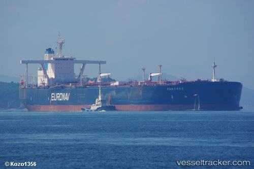
 Sea Horizon
Current Status
Where is the vessel?
Sea Horizon is currently in Near TANJUNG PELEPAS, based on AIS data received about 2h ago.
Latest AIS update:
Current position: 1.22702° N, 103.56938° E (Near TANJUNG PELEPAS)
Average speed (last 7 days): Loading…
Average speed (last 30 days): Loading…
Vessel profile: Sea Horizon is a Crude Oil Tanker with dimensions 333m x 60m.
This page combines live AIS, route history, probable destination signals, nearby traffic, and port activity for practical vessel monitoring.
The current position of vessel Sea Horizon is 1.22702 lat / 103.56938 lng. Updated: 2026-04-09 17:44:57 UTCNearest reference points:
- Near Nipah
- Near Tuas
- Near JURONG ISLAND
Currently sailing under the flag of Marshall Is ![]()
Sea Horizon built in 2001 year
Deadweight:
298412 tDetails:
Live Vessel Sea Horizon Analytics (details, animations, etc.)
Recent AIS points (UTC):
2026-04-09 12:15:06 UTC · 1.22668, 103.56872 · SOG 0 kn · COG 110°2026-04-09 14:18:00 UTC · 1.22755, 103.56921 · SOG 0.2 kn · COG 146°
2026-04-09 16:17:57 UTC · 1.22710, 103.56911 · SOG 0 kn · COG 141°
2026-04-09 17:44:57 UTC · 1.22702, 103.56938 · SOG 0.1 kn · COG 148°