 vesseltracker.com
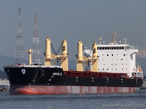
Mv Nikos N
Current StatusWhere is the vessel?
Mv Nikos N is currently in Near Oran, based on AIS data received less than 1h ago.
Latest AIS update:
Current position: 35.71242° N, 0.63551° W (Near Oran)
Average speed (last 7 days): Loading…
Average speed (last 30 days): Loading…
Vessel profile: Mv Nikos N is a Bulk Carrier with dimensions 32m x 190m.
This page combines live AIS, route history, probable destination signals, nearby traffic, and port activity for practical vessel monitoring.
The current position of vessel Mv Nikos N is 35.71242 lat / -0.63551 lng. Updated: 2026-04-12 07:04:12 UTCNearest reference points:
- Near Oran
- Near Arzew
- 30 nm N of Mers El Kebir
Details:
Live Vessel Mv Nikos N Analytics (details, animations, etc.)
Recent AIS points (UTC):
2026-04-10 04:19:35 UTC · 35.71246, -0.63541 · SOG 0 kn · COG 187°2026-04-10 05:25:35 UTC · 35.71238, -0.63544 · SOG 0 kn · COG 187°
2026-04-10 08:04:35 UTC · 35.71246, -0.63541 · SOG 0 kn · COG 187°
2026-04-12 07:04:12 UTC · 35.71242, -0.63551 · SOG 0 kn · COG 187°