 vesseltracker.com
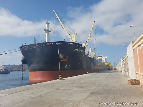
Gh Rich Wall
Current StatusWhere is the vessel?
Gh Rich Wall is currently in 115 nm N of PANGKAL BALAM, based on AIS data received about 1h ago.
Latest AIS update:
Current position: 0.26500° S, 106.68667° E (115 nm N of PANGKAL BALAM)
Average speed (last 7 days): Loading…
Average speed (last 30 days): Loading…
Vessel profile: Gh Rich Wall is a Bulk Carrier with dimensions 32m x 199m.
This page combines live AIS, route history, probable destination signals, nearby traffic, and port activity for practical vessel monitoring.
The current position of vessel Gh Rich Wall is -0.26500 lat / 106.68667 lng. Updated: 2026-04-07 09:54:46 UTCNearest reference points:
- 69 nm NE of Exspan
- Near PANGKAL BALAM
- 46 nm NW of Tanjung Pandan
Details:
Live Vessel Gh Rich Wall Analytics (details, animations, etc.)
Recent AIS points (UTC):
2026-04-07 04:03:47 UTC · 0.35333, 105.87833 · SOG 12 kn · COG -1°2026-04-07 05:42:47 UTC · 0.15167, 106.13333 · SOG 2 kn · COG -1°
2026-04-07 07:22:01 UTC · 0.06709, 106.23897 · SOG 13 kn · COG 128°
2026-04-07 09:54:46 UTC · -0.26500, 106.68667 · SOG 13 kn · COG -1°